Skip to content
Studio Klopfer
Menu
Archive
Gallery
Studio
Search
Line
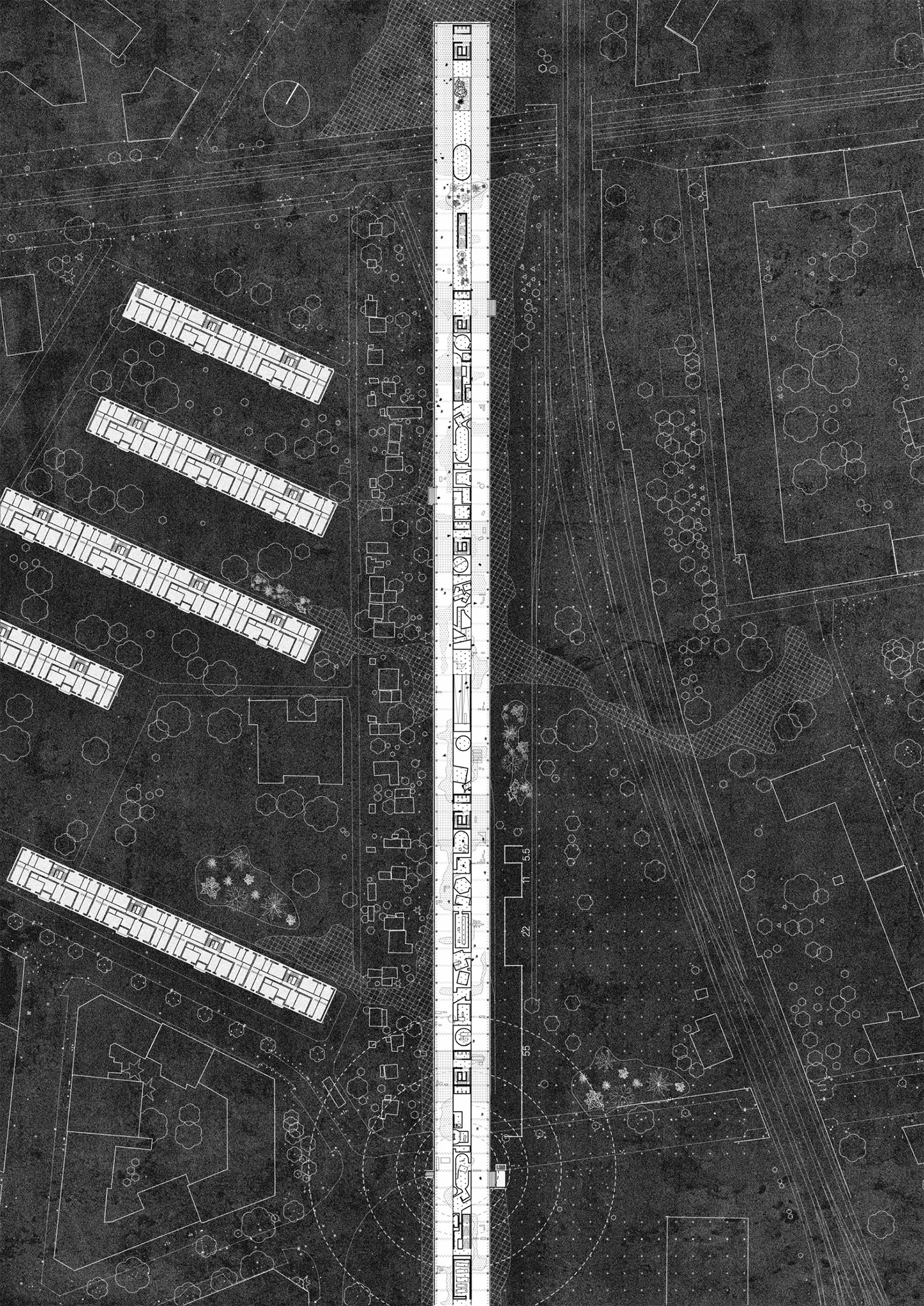
2017—
2018
Architecture
,
Project
info
Vienna
Prev
Field 02
Garten 01
Next
Field 01
2024
Artwork
,
Painting
info
Acryl, Ölkreide auf Karton
78 x 135 cm
Series: Abstracted Fields
Field 02
2024
Artwork
,
Painting
info
Acryl, Ölkreide, Bleistift auf Leinwand
10 x 10 x 10cm
Series: Abstracted Fields
Field 03
2024
Artwork
,
Painting
info
Acryl, Ölkreide, 3 Holzplatten
266.5 x 150.5 cm
Series: Abstracted Fields
Garten 01
2022
Artwork
,
Painting
info
Acryl on Canvas
80 x 100 cm
Series: Gärten und Landschaften
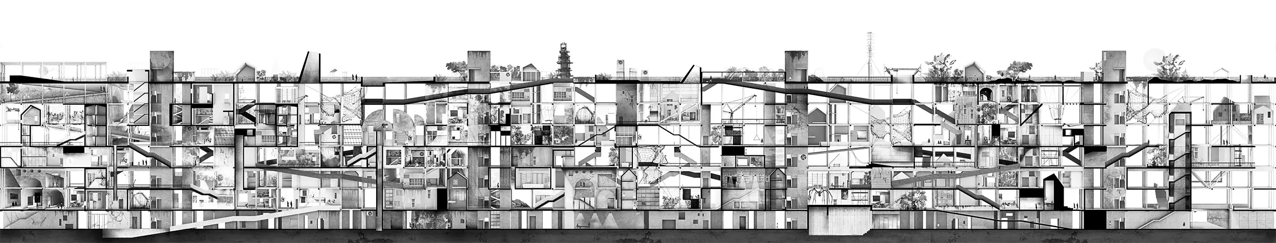
Line
2017—
2018
Architecture
,
Project
info
Vienna